Warning: mysql_result(): state not found in MySQL result index 3 in /home/leagan1/ericandleandra.com/waterfalls_admin/waterfall_page_creator.php on line 51
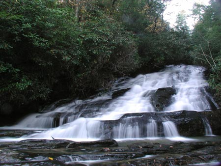
Lower Licklog Falls

photo taken 11/1/2003
Location: South Carolina
Note: We stood on the sandy beach below the falls for this shot.
Directions: From Walhalla, take SC 28 northwest for about 9 miles and make a right on SC 107. Drive 3 miles and turn left onto Village Creek Road just past Oconee State Park. Drive 1.7 miles and turn right onto graveled Nicholson Ford Road (FS775). Drive 2 miles until you reach the parking area on the right. From the parking area follow the Foothills Trail (white blaze) for 0.5 mile and turn left onto the Chattooga Trail (black blaze). You will reach Pigpen Falls on the Chattooga Trail after 0.2 miles. Cross the footbridge, continue past Upper Licklog Falls and look for a steep path down the hillside on the right to see Lower Licklog Falls empty into the Chattooga River.
GPS: 34.931929,-83.129768 (approx.)
Other waterfalls nearby: Upper Licklog Falls, Pigpen Falls

