Warning: mysql_result(): state not found in MySQL result index 3 in /home/leagan1/ericandleandra.com/waterfalls_admin/waterfall_page_creator.php on line 51
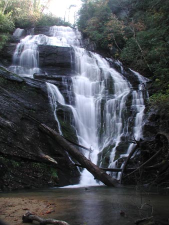
Kings Creek Falls

photo taken 11/2/2003
Location: South Carolina
Note: The hike is easy/moderate but watch your footing on the uneven, wet and narrow trail as you approach the falls. You'll see a nice cascade before reaching the large falls.
Directions: From Walhalla, take SC 28 north to SC 107. Turn right onto SC 107 and drive 17 miles to Burrells Ford Road (FS708). Proceed down FS708 for 2.6 miles to the large campground parking area on the left (look for the bathrooms). If you cross the bridge over the Chattooga River around the bend to the left, you've gone too far. Walk past the gate at the back of the parking area down the wide dirt road around the corner to the left for about 5-6 minutes and take a spur trail on the left to the falls trail after you pass some camping areas on the right. Finding the spur trail was a little tricky; you'll see a sign for the Kings Fall trail on the spur trail after about 0.25 miles. About 2.5 miles RT from the parking area to the falls and back.
GPS: 34.96619,-83.111229 (approx.)

